MAPS
of
HUNGARY

| HUNGARIAN VILLAGE FINDER, ATLAS, and GAZETTEER for the KINGDOM of HUNGARY |
 |
MAPS of HUNGARY |
 |
| **An atlas,
gazetteer, and encyclopedia of maps for anyone researching in the
historical Kingdom of
Hungary, Old Hungary, Austria
Hungary, Hungarian Empire, Austria
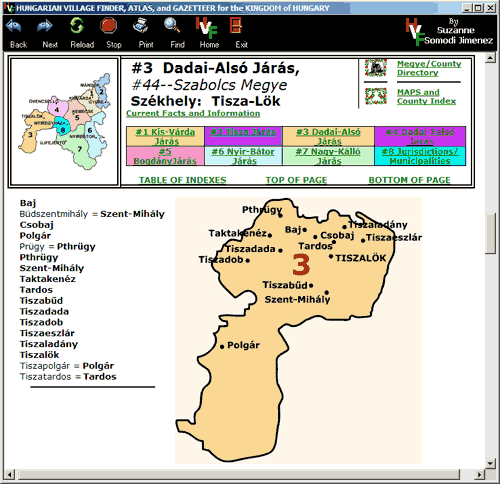
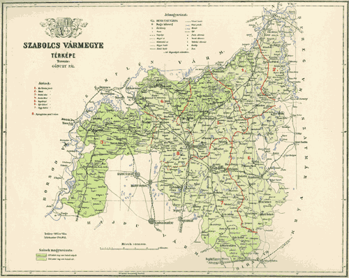
Hungary, and/or Austro-Hungarian Monarchy. **Includes a complete INDEX for locating or finding towns, villages, cities, places, settlements, and place names that were formerly in the Kingdom of Hungary (pre 1918), including those now located in Austria, Croatia, Hungary, Poland, Romania, Slovakia, Slovenia, Ukraine, and Serbia / Yugoslavia. **Includes place names located in the areas or regions commonly known as or referred to as, Banat, Batschka, Burgenland, Erdeley, Kartapalja, Ruthenia, Transylvania, Vojvodina, or Zakarpattia. **With links to church and parish information for help in locating birth, marriage, and death information for each town or village. **The HUNGARIAN VILLAGE FINDER, ATLAS, and GAZETTEER for the KINGDOM of HUNGARY (HVF)- available for DOWNLOAD or on CD-ROM, has reference maps for individual countries, counties (megyes / varmegyes), AND for every district (járás) located within each county. (Screen
shot examples from the Hungarian Village Finder...)
- Countries -
  - Counties (megye/vármegye) -
 - District (járás) -
with place names
 - Including online (Internet) links to -
 
|
|
Hungarian Village Finder,
Atlas, and Gazetteer for the Kingdom of Hungary (website) and Hungarian Village Finder, Atlas, and Gazetteer for the Kingdom of Hungary (software) Copyright 2001-2006 All rights reserved. |